
URBAN WHITEPAPER
Want to read more about what the Urban-Engine does and can? Read our white paper here!
Read WhitepaperData driven public transport planning evaluation
Urban Engine can provide an objective data driven evaluation of your network planning. The evaluation will be based on the current state of the public transport network, this will be scored by Urban-Engine. The scoring gives a detailed geographical map which in one clear view shows the quality of the network. When the current network is scored, changes and alterations in routes and frequencies can be applied, after which the new proposed network will be scored. Both the current and the proposed plan are then compared with each other which directly provides insight in the improved regions versus the deteriorated regions in terms of reachability.
The resulting insights can be used to strengthen your proposition for change, highlight service improvements or start a dialogue based on the results.
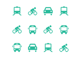
Insight in the quality of modalities
The (electric) bike and the car are fierce competitors for the bus. But do you know exactly how competitive other modalities are? The Urban-Engine makes the effectiveness of each modality visible for your area of interest. Whether it is postcodes, operating area or custom area, the Urban-Engine can provide this information on a low-level map. Allocate your focus and resources to the areas that need it most and create the synergy with other modalities to improve the best door to door experience of your passengers.
Our team has years of experience of working closely with operators. We understand the need for reliable, understandable information regarding network planning. Urban Engine has been battle tested in both operational and tender processes where quick turnaround time is of the essence. Our focus has been on providing high quality information which are visually pleasing.
Interested? Want to know more? Contact us.
Want to read more about what the Urban-Engine does and can? Read our white paper here!
Read WhitepaperUrban-Engine is constructed of multiple features that individually can be used to highlight and strengthen analysis.

How far can you travel within a certain time period?

Reachability performance indicators on hectare level.

How many options can you take to your destination?

Evaluate current service plans and test future service plans.
Compare bike, bus, train and car or combine modalities to evaluate attractiveness for the traveler.

Want to know more about a specific topic? Please contact us and we’ll get back to you as soon as possible!